https://www.ostechnix.com/mapscii-world-map-terminal
 I just stumbled upon an interesting utility. The World map in the Terminal! Yes, It is so cool. Say hello to MapSCII, a Braille and ASCII world map renderer for your
xterm-compatible terminals. It supports GNU/Linux, Mac OS, and Windows.
I thought it is a just another project hosted on GitHub. But I was
wrong! It is really impressive what they did there. We can use our mouse
pointer to drag and zoom in and out a location anywhere in the world
map. The other notable features are;

Cool, yeah?
To switch to Braille view, press c.

Type c again to switch back to the previous format.
To scroll around the map, use arrow keys up, down, left, right. To zoom in/out a location, use a and z keys. Also, you can use the scroll wheel of your mouse to zoom in or out. To quit the map, press q.
Like I already said, don’t think it is a simple project. Click on any location on the map and press “a” to zoom in.
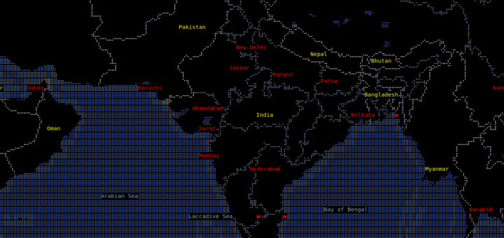
Here are some the sample screenshots after I zoomed it.

I can be able to zoom to view the states in my country (India).

And the districts in a state (Tamilnadu):

Even the Taluks and the towns in a district:

And, the place where I completed my schooling:

Even though it is just a smallest town, MapSCII displayed it accurately. MapSCII uses OpenStreetMap to collect the data.
Make sure you have installed Node.js on your system. If not, refer the following link.
Then, run the following command to install it.
Cheers!
Resource:

- Discover Point-of-Interests around any given location
- Highly customizable layer styling with Mapbox Styles support
- Connect to any public or private vector tile server
- Or just use the supplied and optimized OSM2VectorTiles based one
- Work offline and discover local VectorTile/MBTiles
- Compatible with most Linux and OSX terminals
- Highly optimizied algorithms for a smooth experience
Displaying the World Map in your Terminal using MapSCII
To open the map, just run the following command from your Terminal:telnet mapscii.meHere is the World map from my Terminal.
Cool, yeah?
To switch to Braille view, press c.
Type c again to switch back to the previous format.
To scroll around the map, use arrow keys up, down, left, right. To zoom in/out a location, use a and z keys. Also, you can use the scroll wheel of your mouse to zoom in or out. To quit the map, press q.
Like I already said, don’t think it is a simple project. Click on any location on the map and press “a” to zoom in.
Here are some the sample screenshots after I zoomed it.
I can be able to zoom to view the states in my country (India).
Even the Taluks and the towns in a district:
And, the place where I completed my schooling:
Even though it is just a smallest town, MapSCII displayed it accurately. MapSCII uses OpenStreetMap to collect the data.
Install MapSCII locally
Liked it? Great! You can host it on your own system.Make sure you have installed Node.js on your system. If not, refer the following link.
Then, run the following command to install it.
sudo npm install -g mapsciiTo launch MapSCII, run:
mapsciiHave fun! More good stuffs to come. Stay tuned!
Cheers!
Resource:

No comments:
Post a Comment